🏰 Namur · Capital of Wallonia · Sambre & Meuse confluence · 2,000 years of history
Citadel of Namur: 2000 Years of History at the Confluence of the Sambre and the Meuse
Perched on the Champeau rocky spur, the Citadel of Namur is one of Europe's largest and best-documented fortified complexes: a Roman oppidum, a counts' castle, the bastion fortress of Vauban and Coehoorn, 4 km of tunnels nicknamed the « Anthill of Europe », and then civic reinvention by Georges Hobé. A war machine that became a platform for culture, memory and leisure.
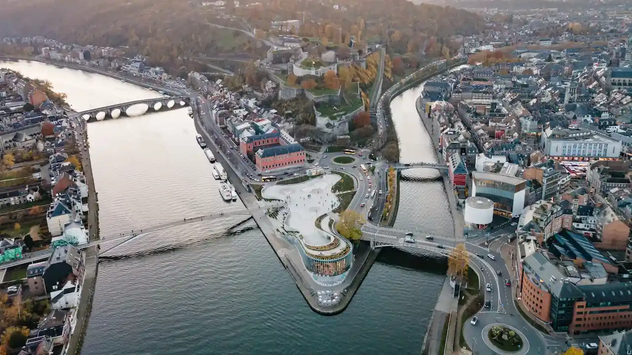
The word citadel, derived from the Italian cittadella (little city), designates the fortress of a town, conceived as the ultimate defensive redoubt and the symbol of sovereign authority. In Namur, that authority inscribed itself in the landscape before it inscribed itself in stone: the complex stands on a triangular rocky spur, the « Champeau », at the confluence of the Sambre and the Meuse.
The deeply incised valleys of both rivers, lined with steep limestone cliffs, form massive natural moats on two of the triangle's three sides. Any attacker was therefore forced to concentrate the siege on the single front facing the rear plateau. This position made Namur an absolute strategic lock, commanding the river links to Charleroi, Dinant and Huy — and later a railway hub towards Brussels, Liège, Mons, Arlon and Luxembourg.
The site nevertheless had two weaknesses that generations of engineers had to compensate for: the Foliette ravine, a concealed approach route on the flank of the spur, and the downward slope of the rear relief, which placed the foremost defensive lines below the plateau from which the enemy arrived. The entire evolution of the citadel — the multiplication of bastions, the progressive burial of the defensive works — can be read as an uninterrupted engineering response to these two original weaknesses.
« The defensive architecture of Namur is a permanent dialectical dialogue between shield and sword: every advance in artillery is answered by a deeper burial of the stone. »
🪨 Champeau rocky spur🌊 Sambre & Meuse confluence🏰 Counts' castle (937)⚔️ Great Siege 1692🛡️ Trace italienne · Médiane🕳️ Anthill of Europe🎭 Georges Hobé 1908-1910🚠 Cable car 2021
Period
Dominant power
Key event
3rd century
Late Roman antiquity
Withdrawal onto the Champeau – stone and timber wall closing off the spur
937–1188
County of Namur (House of Namur)
Counts' castle: keep, 4 towers, collegiate church and deep wells
1188
County of Hainaut (Baldwin V)
Decisive siege – Namur falls under the orbit of Hainaut
1519–1555
Empire of Charles V
Trace italienne: creation of the bastioned « Médiane »
1631–1675
Spanish Netherlands
Construction of the vast advanced « Terra Nova » complex
1692–1695
Kingdom of France (Louis XIV / Vauban)
Great Siege, overhaul of the defences, expansion of the tunnels
1695
Coalition (William III / Coehoorn)
Recapture and refortification erasing Vauban's work
1746
Kingdom of France (Marshal de Saxe)
New siege – prelude to the victory at Rocoux
1792
French Republic (Gen. Valence)
Austrian capitulation after the Battle of Jemappes
1815–1830
United Kingdom of the Netherlands
Near-total reconstruction – ~90% of the current masonry
1888–1892
Kingdom of Belgium (Brialmont)
Belt of 9 concrete forts – end of the citadel's role
1914
First World War (German Empire)
Fall in 3 days – obsolescence of masonry defences
1908–Today
City of Namur (G. Hobé then culture)
Leisure plateau, scenographic tunnels, cable car
Photo gallery
Citadel of Namur in pictures
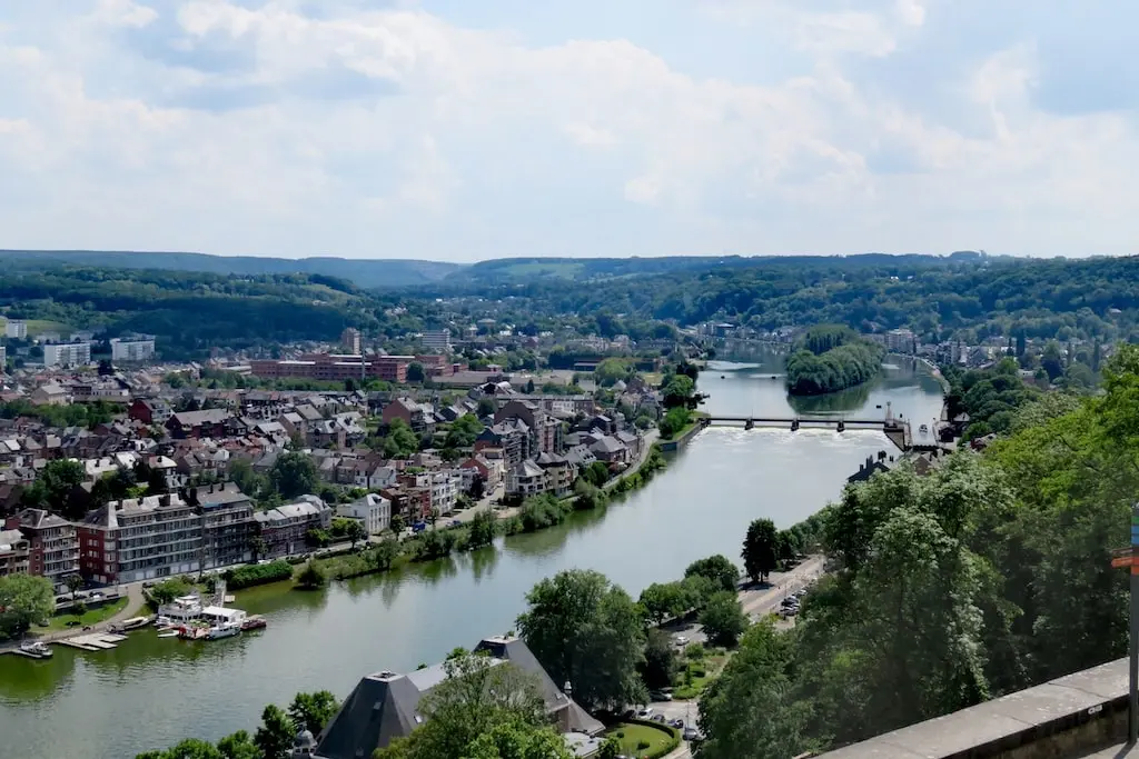
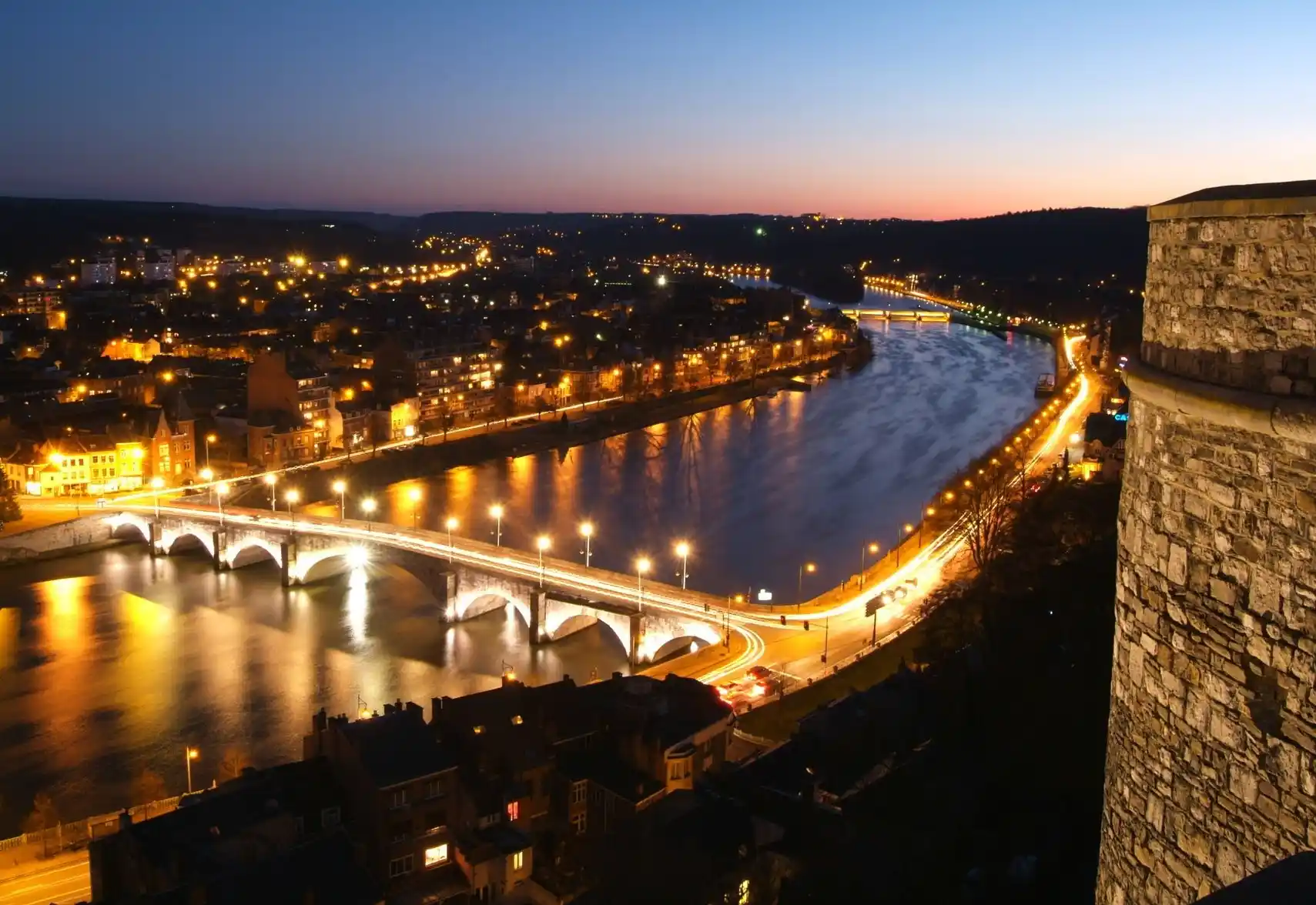
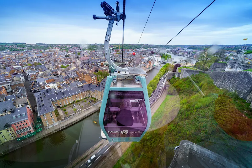
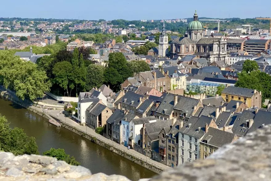
Aerial view of the confluence of the Sambre and the Meuse, dominated by the Champeau spur and the Citadel of NamurDaytime panorama over the Meuse from the heights of the Citadel of NamurNight panorama over the Meuse and the Jambes bridge from the citadel rampartsNew cable car of Namur (POMA, 2021) crossing the Sambre towards the esplanadeView from the ramparts over the old town of Namur and Saint-Aubain cathedral
📜 Geopolitical and military analysis · 3rd century – 1977
Two thousand years of military and architectural history
From the withdrawal of the Roman population onto the spur to the final departure of the para-commandos, the citadel has concentrated every upheaval of Western Europe. Here is the chronology of a unique palimpsest, in which each century rewrote the stone of the previous one.
3rd century
Roman withdrawal onto the Champeau
Faced with insecurity on the borders of the Empire and after a devastating fire in the lower town, the population withdraws onto the spur. A stone and timber wall closes off its tip, coupled with a dry ditch: this is the birth of the site's military vocation.
First defensive lock
937 – 1188
The counts' castle and the House of Namur
Count Berengar settles in the castrum in 937; Robert I structures the House of Namur. The site is equipped with a keep, a wall with four towers, a collegiate church and deep wells. The siege of 1188 brings Namur under the orbit of Hainaut (Baldwin V).
Keep · 4 towers · collegiate church
1519 – 1555
Charles V and the « Médiane »
Gunpowder artillery makes the high walls obsolete. Under Charles V the paradigm reverses: one digs in to absorb the blows. The trace italienne gives birth to the « Médiane » — a low, thick, earth-filled curtain wall, flanked by two casemated bastions.
Trace italienne · bastions
1631 – 1675
The « Terra Nova » expansion
To push the enemy artillery far from the heart of the place, Spain builds the vast advanced complex of Terra Nova: an immense hornwork flanked by demi-bastions. The fortress now stretches over almost the entire Champeau plateau.
Hornwork
1692
The Great Siege – Vauban vs Coehoorn
Louis XIV and Vauban besiege Namur: ~120,000 men and 151 guns against 8,000 to 9,000 defenders commanded by Coehoorn. The town capitulates on 5 June; the citadel holds out for 36 days and surrenders on 30 June. The fall of Namur triggers the Battle of Steenkerque.
120,000 men · 36 days
1695 – 1746
The shifting hegemonies
In 1695 a coalition led by William III recaptures the place; Coehoorn is tasked with erasing the work of his rival Vauban. In 1746, during the War of the Austrian Succession, Marshal de Saxe retakes Namur — a direct prelude to the victory at Rocoux.
Coehoorn refortifies
1792
The revolutionary surge
In the wake of Jemappes, General Valence appears with 35,000 men against an Austrian garrison of 2,300 soldiers entrenched in the citadel. Despite numerical inferiority, the Austrians hold out until 2 December 1792.
Austrian capitulation
1815 – 1830
The Dutch reconstruction
After the Congress of Vienna, the United Kingdom of the Netherlands rebuilds the complex almost entirely following Vauban's and Coehoorn's layouts. Nearly 90% of the masonry visible today dates from this period, marked by the massive use of pre-industrial brick.
~90% of the current build
1888 – 1892
Brialmont and obsolescence
The explosive shell and rifled guns condemn the masonry fortress. General Brialmont has a belt of nine concrete forts built several kilometres from the town: the « Fortified Position of Namur ». The citadel loses its direct defensive role.
9 concrete forts
August 1914
The lightning siege of the Great War
~37,000 Belgian defenders against ~107,000 Germans (2nd and 3rd armies). The heavy artillery pulverises the unreinforced concrete of the forts. After three days, the garrison evacuates on the night of 23 August; the last fort surrenders on 25 August. Static defence has had its day.
Fall in 3 days
1977
The departure of the para-commandos
After the Second World War, the site still serves as a barracks and training ground. The departure of the para-commando regiment in 1977 formally closes the purely military history of the citadel.
End of the martial vocation
⚔️ Two geniuses, two doctrines
The soil of Namur preserves the engraved imprint of the rivalry between the two greatest engineers of the classical age. Sébastien Le Prestre de Vauban championed « industry and method »: parallel trenches, zigzag saps, rigorous geometry to spare his infantry.
His Dutch rival Menno van Coehoorn, defender of the citadel in 1692 and then its refortifier after 1695, favoured a more aggressive approach. Vauban openly scorned the phrase « to attack à la Coehorn », which he saw as needless « murderous violence ». The arrangement of the bastions and ditches of Namur remains the open-air manual of this confrontation.
🛡️
The Brialmont belt (1888-1892)
Aware that the explosive shell rendered the citadel obsolete, the Belgian government entrusted General Henri Alexis Brialmont with designing a modern national defence: nine semi-buried forts in unreinforced concrete (including Saint-Héribert and Émines), several kilometres from the town. In 1914, however, their unreinforced concrete was pulverised in three days by the heavy German artillery.
⚔️ 1692 · War of the Grand Alliance
The Great Siege of 1692: the golden age of siegecraft
Louis XIV in person before Namur
In 1692 Louis XIV decides to strike a great blow to break the Grand Alliance. He personally leads the siege of Namur, accompanied by his chief engineer Vauban. Taking this place, at the confluence of major logistical rivers of Europe, was meant to force the Dutch Republic to negotiate — the French strategy even including preparations for an invasion of England.
The lower town capitulates as early as 5 June, but the citadel, defended in person by Coehoorn, holds out heroically for 36 days under a deluge of fire before surrendering on 30 June 1692. Losses amount to nearly 7,000 killed or wounded on the allied side, 4,000 on the French side. The shockwave across Europe will trigger the bloody Battle of Steenkerque.
~120,000French besiegers
151Pieces of artillery
8-9,000Allied defenders
36 daysResistance of the citadel
💡 During the French occupation (1692-1695), Vauban undertook a colossal overhaul: advanced works, bombproof barracks and, above all, a massive expansion of the tunnel network — the future heart of the « Anthill of Europe ».
🛡️ Trace italienne · Médiane · Terra Nova · Dutch reconstruction
The architecture: the gunpowder revolution and the trace italienne
The citadel you see today is a stacking of doctrines. The shift from the vertical medieval keep to the lowered, buried profiles of the bastion fortress tells, on its own, the transformation of the art of war between the 16th and the 19th centuries.
📉
Dig in rather than rise up
The high vertical walls of the medieval castle, effective against ladders and catapults, collapsed under cannonballs. The trace italienne reverses the paradigm: low, very thick, earth-filled walls whose plasticity absorbs the energy of the projectiles without shattering.
16th century · gunpowder
🧱
Charles V's « Médiane »
The rivalry between Charles V and Francis I accelerates the works from 1519. The Médiane consists of an imposing curtain wall and two flanking bastions, each housing a bombproof vaulted casemate from which the cannon fired in enfilade to mow down the assaulting infantry.
Curtain · bastions · casemates
🏯
The « Terra Nova » shield
Between 1631 and 1675, Spain pushes the land defence line far from the heart of the place with an immense hornwork flanked by demi-bastions. The fortress then occupies almost the entire plateau, erasing any civil or agricultural use of the spur.
Hornwork · 1631-1675
🇳🇱
90% stone… Dutch-made
Often overlooked fact: nearly 90% of the ramparts and façades date neither from the Spanish era nor from Vauban, but from the Dutch reconstruction (1815-1830), which reused the old layouts but replaced the limestone with pre-industrial brick.
Reconstruction 1815-1830
A short glossary of bastion fortification
Term
Strategic function and defensive mechanism
Casemate
A vaulted shelter, underground or integrated into the ramparts, resistant to plunging artillery fire. Used for secure storage or masked fire.
Bastion / Demi-bastion
A polygonal work projecting at the corners of the enclosure. Allows crossfire (flanking) to eliminate blind spots and protect the curtain walls.
Curtain wall
The straight main wall between two bastions. The prime target for breaches, hence its protection by the bastions.
Ravelin
An isolated outwork placed in front of the curtain. Divides the attack, protects the gates and forces the attacker into a preliminary siege.
Hornwork
A massive forward work of two demi-bastions joined by a curtain, pushing the front far from the main body of the place.
Pas-de-souris (mouse step)
A narrow stair on the slopes of the ditches for the rapid movement of the defending infantry during sorties.
🕳️ Underground heritage · Vauban 1692-1695
The « Anthill of Europe »: 4 km of galleries
Although the surface was reshaped by the Dutch, the real treasure of Namur lies underground. A labyrinthine network hand-dug between the 16th and 20th centuries and developed above all by Vauban (1692-1695) earned the site its nickname « Anthill of Europe ». These galleries allowed invisible communication between bastions, the transport of gunpowder and a system of counter-mines meant to blow up the enemy trenches. About 4 kilometres are preserved intact, at a cool and constant temperature all year round.
🧱
Structural works & stability (€930,000)
Stabilisation of the vaults, treatment of infiltrations, replacement of 83 tonnes of stone, 8,500 bricks laid, 100 tonnes of lime mortar, 600 m² of render.
🎬
Immersive scenography (€1,140,000)
18 km of hidden cabling, 700 m of technical trunking, HD video mapping (1,500 Gb after 5,120 hours of modelling) and directional sound.
🌡️
Geological thermal inertia
The constant coolness of the galleries testifies to the excellent natural ventilation designed by the engineers of the 17th-18th centuries.
🎓
An open-air classroom
Educational packs (primary and secondary) turn the galleries into a learning tool: timelines, hypotheses, confrontation with the reality of the confined space.
~4 kmpreserved galleries
1692-1695developed by Vauban
€2.07Mrestoration & scenography
Counter-minesunderground warfare
🎭 1908-1910 · The peaceful revolution
Georges Hobé: from war machine to leisure plateau
Once the strategic role had passed to the Brialmont forts, the City of Namur and Leopold II decided to transform the military scar into a tourist jewel. The Brussels architect-decorator Georges Hobé (1854-1936) redraws the vocation of the plateau. His masterpiece, the two-sided complex of the Stade des Jeux and the Théâtre de Verdure (1908-1910), is one of Belgium's first major civil structures in Hennebique-system reinforced concrete.
100 mof standsat the Stade des Jeux
7,000+glass bricks≈ 3,000 preserved from before 1914
2016listingexceptional heritage
🏛️ « Ludus pro Patria »
The royal box, the focal point of the façade, bears the motto « Ludus pro Patria » (« Games for the Fatherland ») and sculpted female allegories of the Sambre and the Meuse. The ultimate audacity: a tunnel beneath the stands allowed a tramway line to pass. More than 7,000 hollow glass bricks caught the light in the promenade.
🔧 Restoration 2024-2027 (≈ €15.88M)
Listed in 2016, the complex has been under restoration since August 2024. The challenge: the pathology of the 1910 concrete. The cosmetic shotcrete (gunite) of the 1970s will be stripped away, then a cathodic protection (a titanium mesh under low voltage) will stop the corrosion of the reinforcement. The site will regain its pinkish-beige render and its green Art Nouveau joinery, under a new exposed-concrete roof resting on just two columns.
♻️ The Hobé Pavilion: a circular-economy training site (2025-2026)
Condemned to demolition on the banks of the Meuse, the charming Hobé Pavilion (1910), with its openwork ironwork, was dismantled stone by stone and saved. In a unique project, the City, the TEC (LETEC), the Union of Heritage Craftsmen and the pupils of the Asty-Moulin technical school join forces to rebuild it near the Théâtre de Verdure as the shelter of the « Namur Citadelle Théâtre de Verdure » stop. The students learn stone-cutting and reinforcement there: heritage rescue becomes the transmission of know-how.
🌿 The pacification of the site · 21st-century ecosystem
An urban district of culture, memory and craftsmanship
The former fortress has become a real district of Namur, perched above the town. Memorial tourism, fine dining, niche crafts and mass events coexist there — the finest example of the peaceful reuse of a military wasteland.
🌸
The Guy Delforge perfumery
Housed since the 1990s in the former munitions stores and the Dutch artillery workshop, the perfumery workshop makes the most of the constant temperature and humidity of the casemates, close to those of a wine cellar, for the maceration of the essences. The contrast between the gunpowder of yesterday and the perfume of today sums up the whole history of the place.
🏛️
Terra Nova, the Visitor Centre
The imposing Terra Nova barracks (17th-18th c.) have been transformed into a vast interpretation centre. An interactive museography retraces more than 2,000 years of urban, geological and military history — the essential educational first step before exploring the site.
🍽️
Château de Namur & Le Panorama
Heir to the Grand Hôtel, the Château de Namur is a hotel-restaurant that serves as a « training hotel » for the Provincial Hotel School (EHPN), holder of the « Green Key » label. The restaurant Le Panorama, with a menu signed by Michelin-starred chef Yves Mattagne, offers a 360° view over the Meuse valley.
🎶
Le Belvédère & the great events
The Belvédère has become a hotspot for contemporary music with more than 200 concerts a year. The plateau also hosts the Festival Nature Namur, the Médiévales, the Xterra extreme triathlon and wine fairs. The LED lighting of the ramparts makes the citadel a nocturnal beacon of the Walloon capital.
🚠 Overcoming the height difference · 1898 → today
Suspended mobility: a century in search of access
Opening a steep plateau over 100 metres above the rivers to the public posed, from the Belle Époque onwards, a mobility challenge that three generations of engineers took up in turn.
System
Period
History
Pioneering funicular
1898 – 1907
The very first funicular in Wallonia linked the town centre to the prestigious « Grand Hôtel ». Crippling operating costs led to its early closure.
Old cable car
1956 – 1997/2002
A series of 47 colourful two-seater cabins carried visitors up to the Belvédère. Suspended in 1997 (threat of a 53-tonne rock fall), it was finished off in 2002 by the arson of its lower station.
New cable car
2021 – present
Inaugurated on 8 May 2021 (POMA), it departs from the Place Maurice Servais, crosses the Sambre and drops users off on the Esplanade, in the spirit of Hobé.
📍 Good to know
The cable car is the most spectacular way to reach the plateau, but you can also go up on foot, by bike or by car via the Route Merveilleuse. The esplanade and the walks along the ramparts are freely accessible.
🎟️ Plan your visit
Visiting the Citadel of Namur: recommended route
The citadel can be discovered in half a day. The outdoor areas (esplanade, parks, ramparts) are freely accessible; the guided offerings — tunnels, Terra Nova, cable car — are paid and have seasonal hours.
1
Reach the plateau
Cable car from the Place Maurice Servais (it crosses the Sambre), or up on foot / by bike / by car via the Route Merveilleuse.
2
Start with Terra Nova
The visitor centre, in the former barracks, sets the scene: 2,000 years of urban, geological and military history in interactive museography.
3
Descend into the tunnels
The guided tour of the « Anthill of Europe » reveals ~4 km of Vauban's galleries, enhanced by video mapping. Bring a light jacket.
4
Walk the ramparts
A free walk along the curtains and Dutch bastions, with panoramas over the confluence, the Meuse, the Jambes bridge and Saint-Aubain cathedral.
5
Hobé's heritage & craft
Stade des Jeux, Théâtre de Verdure and the Delforge perfumery workshop in the casemates. Depending on the season, a concert at the Belvédère extends the visit.
🎟️ Prices & hours
The prices and hours of the tunnels, Terra Nova and the cable car vary depending on the season and the combined packages. For up-to-date information before your visit, check the official ticketing of the City of Namur: citadelle.namur.be.
Frequently asked questions
FAQ – Citadel of Namur 2026
Why was the Citadel of Namur built on this site?
It rises on the triangular « Champeau » rocky spur, at the confluence of the Sambre and the Meuse. The incised valleys form natural moats on two of the three sides, exposing only one front on the plateau side. This position commanded the river links to Charleroi, Dinant and Huy. Occupation goes back to the Upper Palaeolithic; militarisation begins in the 3rd century.
What was the Great Siege of 1692?
In 1692 Louis XIV and Vauban besiege Namur with ~120,000 men and 151 cannon against 8,000 to 9,000 defenders commanded by Coehoorn. The town capitulates on 5 June; the citadel holds out for 36 days and surrenders on 30 June. The siege pits Vauban's rigorous method against Coehoorn's aggressive approach. The fall of Namur triggers the Battle of Steenkerque.
Why is it called the « Anthill of Europe »?
The citadel houses a network of hand-dug galleries created between the 16th and 20th centuries, of which ~4 km are preserved intact. Developed above all by Vauban (1692-1695), it ensured invisible communication between bastions, the transport of gunpowder and the counter-mines. Its density earned it this nickname. An immersive tour (video mapping, directional sound) is offered today.
From which period does the visible masonry date?
Contrary to a common belief, nearly 90% of the visible ramparts and façades date from the Dutch reconstruction (1815-1830), after the Congress of Vienna — and not from the Spanish era or from Vauban. The Dutch reused the old layouts and made massive use of pre-industrial brick.
Who was Georges Hobé?
The architect (1854-1936) who transformed the military scar into a leisure plateau between 1908 and 1910. His masterpiece, the Stade des Jeux and Théâtre de Verdure, is one of Belgium's first major civil structures in Hennebique reinforced concrete (royal box « Ludus pro Patria », allegories of the Sambre/Meuse, 7,000+ glass bricks). Listed in 2016, it is being restored from 2024 to 2027 (~€15.88M).
How do you get up to the citadel?
The most spectacular way is the cable car inaugurated on 8 May 2021 (POMA): it departs from the Place Maurice Servais, crosses the Sambre and drops visitors off on the esplanade. You can also go up on foot, by bike or by car via the Route Merveilleuse.
Is there really a perfumery in the citadel?
Yes. The Guy Delforge workshop has been housed since the 1990s in the former munitions stores. The constant temperature and humidity of the casemates, close to those of a wine cellar, provide ideal conditions for the maceration of the essences — a striking symbol of the pacification of the site.
Is access to the citadel paid?
The esplanade, the parks and the walk along the ramparts are freely accessible. Paid, on the other hand, are: the guided tour of the tunnels, the Terra Nova visitor centre and the cable car. As prices change by season, it is best to check the official ticketing (citadelle.namur.be) before your visit.
Two thousand years of history at the confluence of the Sambre and the Meuse. Freely accessible ramparts, Vauban's tunnels, a panoramic cable car and the heritage of Georges Hobé: a journey from war to culture.
Ouvert tous les jours du 01/04 au 31/10. Fermé le 1er samedi de juin pour l'ouverture de la pêche.
Enter the information to see the rate…
Vos coordonnées
Finaliser la réservation
🔒 Paiement 100% sécurisé via Stripe. Pour valider votre réservation, nous demandons un acompte correspondant aux frais de la plateforme (10%). Le solde sera à régler sur place chez notre partenaire. L'adresse précise et le nom du prestataire vous seront communiqués par e-mail juste après.
Acompte demandé :
Solde à payer sur place :
🌿 Kayaking on the Ourthe LIVE
Ourthe · 7,8 km · Comblain-au-Pont · Saison 2026
★★★★★🏆KSA🏆
Rated 4.6/5 based on 1,282 reviews
Avis Google
Établissement Recommandé
4.6
Basé sur 1,282 avis
J
Jean-Luc Demaret G
« Une journée parfaite en famille sur la Semois. L'accueil d'AmiPierre est chaleureux, le matériel est impeccable (les kayaks sont modernes et propres), et le système de navettes gratuites est super bien organisé. Une adresse incontournable dans les Ardennes ! »
A
Annelies Peeters G
« Prachtige kajaktocht op de Semois vanaf Vresse! Zeer vriendelijk personeel en een uitstekende service met de pendelbus. De bijbehorende camping Au Petit Ben Gneur is ook een absolute aanrader voor natuurliefhebbers. »
P
Pierre-Yves Dubuisson G
« Superbe descente de 11km en kayak au départ de Alle-sur-Semois. La nature sauvage de l'Ardenne est magnifique sous le soleil du printemps. Tarifs très compétitifs par rapport à la concurrence. On reviendra ! »
S
Sandra Müller G
« Wunderschönes Erlebnis! Die Kajaktour auf der Semois war top organisiert. Das Team ist sehr hilfsbereit und spricht gut Deutsch. Die Landschaft der belgischen Ardennen ist einfach atemberaubend. »
D
Damien Claes G
« Excellent service de location de kayak et super camping au bord de la Semois. Les prix sont très corrects et l'ambiance est conviviale et familiale. Le petit bar-terrasse est parfait pour se désaltérer après l'effort. »
S
Sophie Mertens G
« Un accueil fantastique de dernière minute alors que nous n'avions pas réservé en plein mois d'août. Les gilets de sauvetage et les bidons étanches sont fournis gratuitement. Descentes très sécurisées, idéal avec les enfants ! »
T
Thomas Wright G
« Top-tier kayak rental on the Semois river. Extremely friendly staff, well-maintained kayaks, and reliable shuttle. The viewpoints along the river are absolutely stunning. Highly recommend this local business! »